
Mt. Tsurugi: The Second Highest Peak in Western Japan and Sacred Ground of Shikoku Shugendo
Mt. Tsurugi: Second Highest Peak in Western Japan and a Sacred Mountain of Shugendo
Mt. Tsurugi, spanning Miyoshi City, Mima City, and Naka Town in Tokushima Prefecture, is the second highest peak in western Japan at 1,955 meters, second only to Mt. Ishizuchi, and the second highest in Shikoku. Long revered as a sacred mountain of Shugendo ascetic practice, it also has gentle bamboo grass meadows near the summit and is popular as a relatively easy climb for beginners. Because the lift makes it easy to gain elevation, a wide range of visitors from serious hikers to families can enjoy its grand nature and mountain faith. This article focuses on the faith and nature. For details of the climbing routes, see the companion Mt. Tsurugi trekking guide.
A Sacred Peak and the Origin of the Name
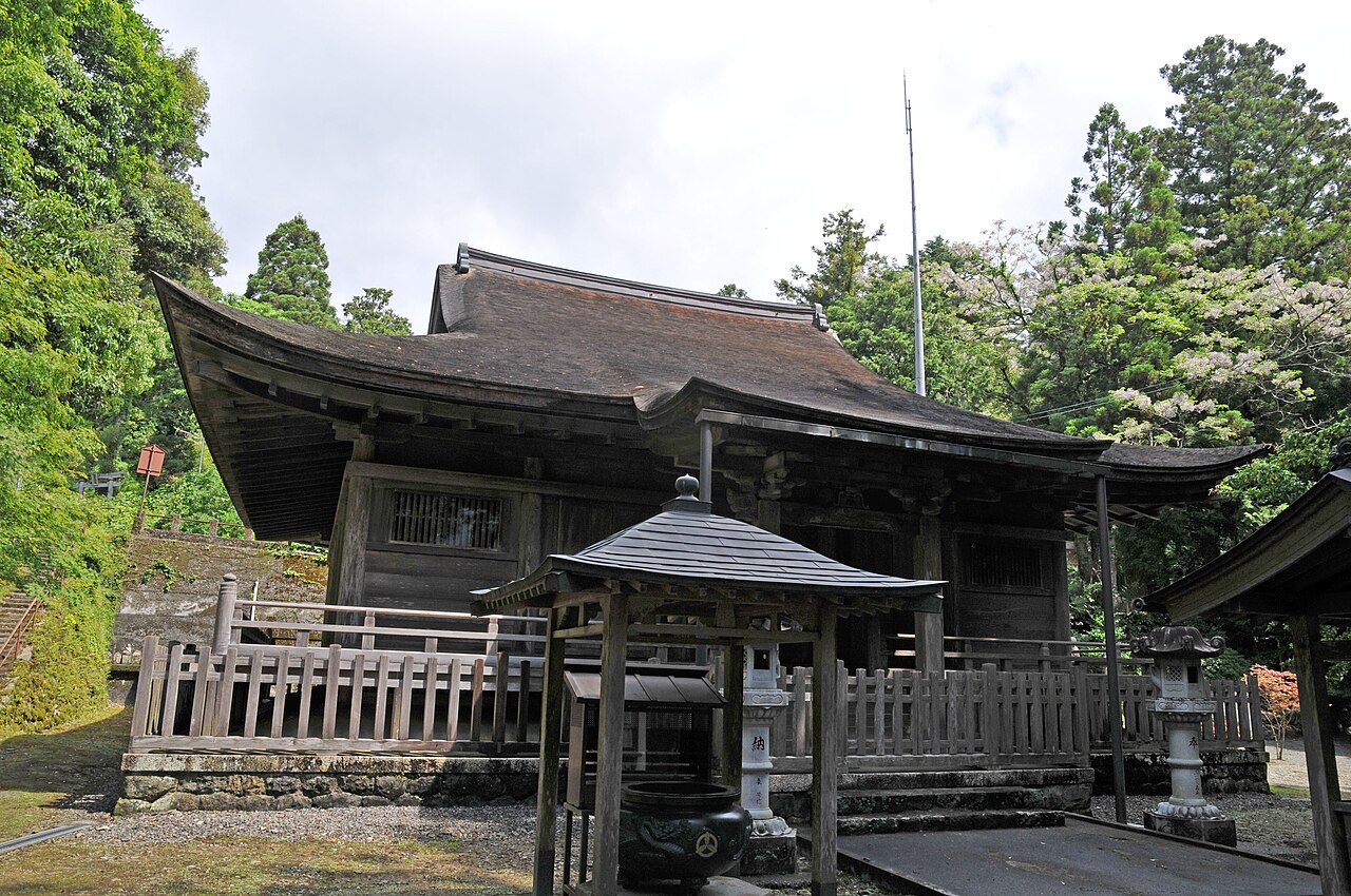
True to its name, Mt. Tsurugi has gathered deep faith as a sacred mountain since ancient times. Several legends explain the name, including one that a sword of Emperor Antoku was enshrined at the summit. Near the summit stand shrines such as Tsurugisan Hongu Hozoiwa Shrine, where ascetics in white robes and pilgrims can be seen. As a sacred ground of Shugendo, this mountain has been a place of prayer through a long history, and a sacred air drifts within its grand nature, quietly steadying the hearts of those who climb.
Gentle Bamboo Grass Meadows and Summit Views
The great appeal of Mt. Tsurugi is its easy access and the views from the summit. Drive to Minokoshi at the foot, then take the lift to reach Nishijima Station near 1,750 meters in about 15 minutes. From the lift it is about one hour on a maintained trail to the summit. Near the top, gentle bamboo grass meadows with boardwalks spread out like a green carpet. From the summit, a view of Jiroukyu and the wider Shikoku range opens up, and on clear days distant peaks are visible in a truly sky high panorama.
Sacred Water and the Bounty of Nature
Partway up the mountain, near Oturugi Shrine, is a spring known as the sacred water of Mt. Tsurugi, cherished as fine water and a place where hikers refresh themselves and pray for safety. Precious alpine plants grow wild on the mountain, with delicate flowers in summer and a golden sweep of bamboo grass in autumn, so natural beauty can be enjoyed through the seasons. The coexistence of a sacred air and rich nature is unique to Mt. Tsurugi.
Access and Basic Information
Minokoshi, the trailhead, is about 2 hours by car from Tokushima city. Public transport is infrequent, so car access is the norm. The Mt. Tsurugi sightseeing lift typically runs from late April to the end of November, at published fares of about 2,300 yen round trip and 1,300 yen one way for adults, and 1,100 yen round trip and 650 yen one way for children as of 2026. Operating dates and hours change by year, so check official information. Some road sections may close in winter.
Practical Travel Notes
The best time to climb is from early summer greenery to the autumn colors of October. To savor the atmosphere of faith, take a route to the summit by way of Oturugi Shrine, the sacred water, and Tsurugisan Hongu Hozoiwa Shrine. As a guide, a summit round trip using the lift takes about 1.5 to 2 hours. Because the elevation is high and the weather changes easily, always carry warm clothing, rain gear, and good walking shoes. Real nearby spots include the ridge to Jiroukyu, the Mt. Tsurugi Summit Hut, and the Iya Valley, Oboke, and Iya Kazura Bridge at the foot, so a two day trip combining the climb with hidden valley sightseeing is rewarding. Budget about the 2,300 yen lift round trip plus food and gear, with lodging extra for a summit hut stay. Weekdays and early mornings are more comfortable for avoiding crowds.
Advice
Mt. Tsurugi is easy to climb with the lift, but the summit area is a genuine high mountain where the weather changes quickly. Because it is also a sacred peak, worship quietly at the shrines and small altars. If you draw the sacred water, a container for carrying it is handy. There is little shade on the bamboo grass ridge, so remember a hat and sun protection. Dates of Shugendo related events and annual festivals vary by year, so check the official information of the shrines and tourism association if you wish to attend or observe.
📚 Sources
This article draws mainly on the guidance published officially or on site by facilities such as the Mount Tsurugi climbing lift and the Tsurugi honmiya shrine, and the sightseeing information of Mima city, Tsurugi town, and Tokushima Prefecture. It also reflects the interpretive signs along the trails and at the summit. Lift operating times and trail conditions may change, so please confirm with the official information of each facility or authority before you set out.
Visitor Checklist
- Estimated time: About half a day using the lift for a round trip to the summit and worship.
- What to bring: Hiking shoes, warm clothing, rain gear, and drinks; the elevation is high and temperatures low.
- How to get around: From Minokoshi take the climbing lift to Nishijima, then walk the trail to the summit.
- Time of day: Mountain weather changes easily, so an early morning start is recommended.
- Note: Beware of sudden weather changes near the summit and fully prepare warm and rain gear.
📍 Location & Access




Share this article


✍️ About this article
This article is compiled by the Tabitabi JAPAN editorial team from official and primary sources, including facility and shrine/temple websites, tourism information published by municipalities and tourism associations, and cultural-property records released by national and local governments. Prices, opening hours and event dates may change, so please also check the official information of each facility or local government before you visit.