
Unpenji Temple and Sanuki Fuji: Kagawa's Famous Peaks and the Highest Temple of the 88 Sacred Sites
Unpenji Temple, straddling Kanonji City in Kagawa Prefecture and Miyoshi City in Tokushima Prefecture, is the 66th sacred site of the Shikoku 88 Temples, sitting near a summit at about 927 meters. As the highest of the pilgrimage temples, it is also called the Koya of Shikoku, wrapped in the pure atmosphere unique to a cloud-touched height. Easily reached by ropeway, this venerated temple also offers a sweeping panorama of the Sanuki Plain and the Seto Inland Sea below.
The Highest of the Pilgrimage Temples
Unpenji is the pilgrimage station at the highest elevation among the Shikoku 88 Temples. Revered as an old temple connected with Kobo Daishi (Kukai), it flourished as a place of ascetic training thanks to its pure atmosphere and came to be called the Koya of Shikoku. The precincts near the summit are filled with a mysterious air, as if one stands above the clouds, and pilgrims and worshippers offer quiet prayers. Highlights are abundant, from the history-laden main hall to the Five Hundred Arhats, rows of stone statues, giving the solemn feel of a sacred mountain. The sight of countless statues with differing expressions is striking enough to stop you in your tracks.
Grand Panorama from the Summit
Unpenji appeals not only for its sacred solemnity but for the majestic view from the summit. From about 927 meters, the Sanuki Plain spreads below, and beyond it the calm Seto Inland Sea and its scattered islands come into view at a glance. The graceful Sanuki Fuji (Mt. Iino) and other Sanuki peaks can be seen, and on clear days the vista reaches far into the distance. When conditions align, a sea of clouds may appear, and the dreamlike view of floating above the clouds is etched deeply into the memory of visitors.

Ropeway and Summit Pleasures
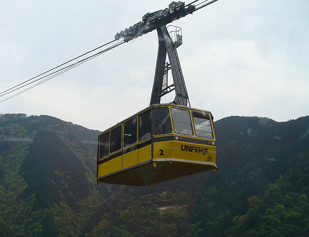
Unpenji can be reached easily by ropeway. The roughly seven-minute aerial ride carries you near the summit while you enjoy the scenery unfolding below. The summit is equipped with viewpoints for taking in the scenery and photogenic features such as a swing that sends you out toward the blue sky, so you can enjoy the views alongside your visit. A ski slope opens in winter, making the site enjoyable through all four seasons. Savoring the solemn moment of pilgrimage together with the open, expansive summit views at once is the charm of Unpenji.
Enjoying the Seasons
Early summer greenery and autumn foliage are especially beautiful at Unpenji. Clear days with crisp air are the finest chance to enjoy the views. Because of the high elevation, the summit is cooler than the town below, refreshing even in summer and sometimes wrapped in snow in winter, so bringing an extra layer is wise. Nearby, the gracefully shaped Sanuki Fuji (Mt. Iino), about 422 meters high, is an easy-to-climb hiking favorite loved by local residents.
Access and Basic Information
The usual route is to drive to the base station of the Unpenji Ropeway and ride up to the summit. The location is relatively close to central Kanonji and to interchanges on the Takamatsu Expressway, easy to combine with a drive along the Seto Inland Sea side. The ropeway may suspend service for strong wind, bad weather, or maintenance, so checking operating status before you go is reassuring. Combining a visit with the pilgrimage route or Kanonji sightseeing is also recommended.
Practical Travel Notes
- Bring a layer. The summit is cooler and windier than town; even in summer a light jacket adds comfort.
- Check ropeway operation. Service may stop for strong wind, bad weather, or maintenance. Confirm the day's status in advance.
- Wear comfortable shoes. The precincts have slopes, stone steps, and gravel paths; sneakers are best.
- Choose your weather. Both the panorama and the sea of clouds depend on clear skies and crisp air. Pick your day by the forecast.
- Pilgrimage etiquette. This is a pilgrimage station. Worship quietly so as not to disturb others prayers.
- Pair with Sanuki Fuji. Mt. Iino (Sanuki Fuji) is an easy hike of about 1.5 to 2 hours one way, a nice add-on if you have time.
A Word of Advice
Unpenji is one of Kagawa's finest viewpoints, letting you feel the solemnity of prayer and the openness of a summit at once. The trick is to choose a clear day and confirm the ropeway is running before setting off. Prepare a jacket for the chilly summit air and take your fill of the grand panorama over the Sanuki Plain and Seto Inland Sea in the clear mountain air.
📚 Sources
Operating times, suspension information, and hilltop highlights of the Unpenji Ropeway can be checked in the official information of the ropeway and Unpenji temple. Its history as the 66th temple of the Shikoku pilgrimage and the highest of the Shikoku sacred sites is also introduced on the information boards in the precinct. For the Sanuki Fuji (Mount Iino) hiking mentioned alongside it, local tourism guidance is helpful. Fees, hours, and access may change, so please confirm the latest details on official sources before you go.
Visitor Checklist
- Time needed: About one to two hours for the ropeway ascent and a hilltop stroll; add roughly half a day for a Sanuki Fuji hike.
- What to bring: The summit is cooler and windier than town, so bring a jacket. The grounds have slopes, steps, and gravel paths, so wear comfortable shoes.
- Suggested route: Take the ropeway to the summit, tour the main hall and the Five Hundred Rakan statues, and enjoy the panorama of the Sanuki Plain and Seto Inland Sea from the viewpoint.
- Weather tip: The views and the sea of clouds depend on clear skies and clean air, so choosing a day by the forecast raises your satisfaction.
Practical Information for Your Visit
- Unpenji Ropeway operating hours: From March to November, 7:40-17:20 (last descent); from December to February, 8:00-17:20 (last descent). Cars run every 20 minutes (on the hour, at 20 past and at 40 past) and the ride takes about 7 minutes. It operates all year round, but may be suspended for inspection and maintenance
- Fares: Adults 2,200 yen return or 1,200 yen one way; junior high and high school students 1,650 yen return or 900 yen one way; elementary school students 1,100 yen return or 600 yen one way. One child under elementary school age travels free with each ticket, and pets may also be brought along free of charge. Groups of 15 or more receive a discount
- Parking: There is a parking lot at the base station. There is no parking at Unpenji Summit Park, and the official guidance is "please be sure to come by the Unpenji Ropeway"
- Getting to the base station: 1974-57 Marui, Onohara-cho, Kanonji City, Kagawa Prefecture (0875-54-4968). About 15 minutes by car from the Onohara IC on the Takamatsu Expressway, or about 25 minutes by taxi from JR Kanonji Station. Because the forest road from Gogo on Prefectural Route 8 requires care with falling rocks, the official guidance is to go via Prefectural Route 241 (past Hagi-no-Oka Park) (large vehicles may not be able to use Route 8)
- Unpenji Summit Park: At an altitude of 920 m. It commands a sweeping view of the Mitoyo Plain and the Seto Inland Sea, and when visibility is good you can see as far as the Great Seto Bridge and Okayama and Hiroshima prefectures. There is a "Swing in the Sky," a wooden photo frame and a lawn area
- Seasonal events: In 2026, "Midsummer Snow Play" is held on Saturdays, Sundays and public holidays from July 18 to August 23, plus August 10 and 14 (the snow falls from 10:00 to 15:00; sledding is not available). In winter, snow play and sledding are usually held from late December to late February
* The viewing hours of Unpenji (the temple) and the reception hours of its sutra-stamp office, and the number of spaces and charges at the base station parking lot, are not officially published. Note also that Unpenji itself is in Miyoshi City, Tokushima Prefecture, while the ropeway base station is in Kanonji City, Kagawa Prefecture. (Sources: Shikoku Cable; Kanonji City)
📍 Location & Access


Share this article


✍️ About this article
This article is compiled by the Tabitabi JAPAN editorial team from official and primary sources, including facility and shrine/temple websites, tourism information published by municipalities and tourism associations, and cultural-property records released by national and local governments. Prices, opening hours and event dates may change, so please also check the official information of each facility or local government before you visit.