
Itsuki Village, Kumamoto: The Clear Kawabe River and the Home of the Itsuki Lullaby
[Important] About the 2026 Kumamoto Earthquake
Because of the Kumamoto Earthquake of 28 July 2026, some tourist facilities and roads in Kumamoto Prefecture may be closed or impassable. Kumamoto Castle reopened on 13 August 2026, but the Kumamoto Castle Museum "Wakuwaku-za" remains temporarily closed (as of 13 August 2026). Please check the official information for each facility before you set out.
Always confirm the latest information on each facility's official website and in announcements from the local authorities before you travel.
Itsuki Village in Kuma District, Kumamoto Prefecture, sits deep in the Kyushu Mountains and covers about 253 square kilometres. Forest accounts for 97 percent of that area and farmland for about 1 percent, so flat ground is scarce. The river running through the village is the Kawabe, the largest tributary of the Kuma River system. The Kuma itself rises in neighbouring Mizukami Village, while Itsuki occupies the upper Kawabe, where clear water and deep forest define the landscape.
The Kawabe River and Riverside Scenery
In the annual water-quality survey of Class A rivers published by the Ministry of Land, Infrastructure, Transport and Tourism, the Kawabe is repeatedly named among the rivers with the best water quality in Japan. The results published on 24 July 2026 again placed it among 13 rivers nationwide, marking the twentieth consecutive year since 2006.
Shirataki Park, on Prefectural Route 25, takes its name from a limestone cliff 70 metres high and 200 metres wide that resembles a white waterfall. The park has a suspension bridge and a small limestone cave about 15 metres deep, lit for 20 minutes for 100 yen. The Itsuki-ogawa stream below is a summer play spot, but the village prohibits camping, tents and open flames there because of the risk of falling rocks.
Itsukigen Park, laid out in front of the former Itsuki Junior High School, has about 1.5 hectares of lawn, combination play equipment, football goals and ground-golf facilities, and a large roofed plaza for rain or events. Fireflies appear along the waterway beside the playground around June.

Two Places That Keep the Itsuki Lullaby Alive
The Itsuki Lullaby is thought to have begun as a nursemaid's song, sung by girls from this poor mountain village who were sent away to work minding other families' children and who longed for home. Neither its author nor its date is known; it was handed down orally, and some 90 sets of lyrics are said to exist. After the war it spread nationwide and became one of Kumamoto's best-known folk songs.
Komoriuta Park, next to the roadside station, has a thatched farmhouse displaying old farm tools and household implements. Storytellers introduce the history and traditions of the village, and live performances of the lullaby can be arranged for groups for a fee. Prize-winning works from a sculpture competition stand in the grounds, which also host seasonal events such as the Doll Festival, a fresh-greenery festival and a summer festival.
For a fuller picture of the village's history, visit Historia Terrace Itsukidani, the village history and culture centre. Alongside exhibition rooms on mountain-village life and culture, it has a children's room and a cafe.

Sixty Years of Dam Plans and a Village Centre Moved Uphill
In July 1966 a dam project was announced for the village. Most of the Toji district, then the village centre with its town hall, was to be submerged. After more than 20 years of opposition, the village consented in 1982 to construction excluding the dam body itself. Work on the Toji replacement site began in 1993, residents began moving into houses there in 2001, and in 2002 the village office and clinic started operating in new buildings. The roadside station Komoriuta no Sato Itsuki opened in April 2004.
Then, in September 2008, the governor of Kumamoto announced the withdrawal of the existing plan, and in 2009 the national government declared the project cancelled. The turning point came with the torrential rain disaster of July 2020. That November the governor called for a flow-through dam dedicated to flood control under a policy of "green basin flood management". The national government began full investigations in 2021, and in August 2022 the dam was written into the river improvement plan for the Kuma River system. In July 2024 the Minister of the Environment issued an opinion on the 107.5-metre-high dam, calling for consideration of habitat for the mountain hawk-eagle, among other matters.
The Toji Ohashi bridge, opened in 2013, was built as part of this relocation. It is 487 metres long and stands about 70 metres above the valley floor, and from the deck you can look down on the site of the old settlement.
Local Flavours: Itsuki Tofu, Yamauni Tofu and Kunebu
Tofu is the village's signature food. Itsuki Tofu Shop makes firm cotton tofu from 100 percent Kyushu-grown soybeans, along with smooth tofu, fried tofu and smoked tofu. Itsukiya Honpo's "yamauni tofu" is tofu cured in miso, named for its melting texture. A large waterwheel across the river from Prefectural Route 25 marks the spot.
Yama no Sachi, the produce hall at the roadside station, sells game products such as venison sausage and jerky, log-grown shiitake, dried bamboo shoots, dried royal fern, buckwheat, konjac, wild honey and shochu. A local speciality is kunebu, a native citrus the village has worked to preserve, sold as ponzu, marmalade and gelato. Kunebu is grown only in Itsuki and a very few other places in Kyushu and Okinawa.
Practical Information for Your Visit
- The Yama no Sachi produce hall at the roadside station Komoriuta no Sato Itsuki (2672-54 Ko, tel. 0966-37-2301) is open 8:30-17:30, with closures around the New Year period.
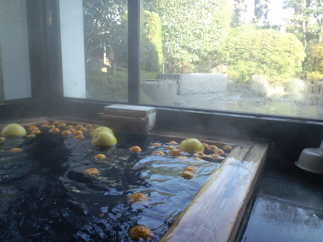
- The adjoining Itsuki Onsen "Yumeuta" is open 11:00-21:00 (last entry 20:30), closed Tuesdays. Admission is 500 yen for adults, 250 yen for elementary school children and under, and 350 yen for those aged 70 and over; on Ladies' Day (Wednesday) women pay 350 yen. The water is weakly alkaline. The Restaurant Yumeuta is currently closed.
- The roadside station car park has 54 spaces for standard cars, 4 for large vehicles and 6 accessible spaces, with separate men's and women's toilets and one accessible toilet.
- Historia Terrace Itsukidani (2672-58 Ko, tel. 0966-37-2121) is open 10:00-17:00, closed Mondays (the following day if a public holiday) and 29 December to 3 January. The exhibition rooms cost 300 yen for adults and 200 yen for elementary and junior high school students; the children's room is 200 yen for elementary school children and free for preschoolers, with a 300-yen combined ticket. There are 50 parking spaces.
- Itsuki Tofu Shop is open 9:00-17:00 (until 15:00 on Wednesdays) and Itsukiya Honpo 8:30-17:00 with 20 parking spaces. Both are closed on Sundays.
- By car from Kumamoto IC, take the Kyushu Expressway to Uki-Hikawa Smart IC, then National Route 3 and Prefectural Route 25, about 1 hour 30 minutes. From Miyazaki or Kagoshima, leave at Hitoyoshi IC and head north on National Route 445, about 2 hours.
- The stretch of National Route 445 from Misato via Nihonsugi Pass and Gokanosho is a narrow, unimproved road where passing is difficult. First-time visitors are better off entering from the Hitoyoshi IC side; the road south of Itsuki is well maintained and easy to drive.
- Shirataki Park has natural rock and riverbed underfoot that can be slippery, so sturdy shoes are needed, and it is not suited to strollers or wheelchairs. The roadside station, Komoriuta Park, Itsukigen Park and the area around Historia Terrace are relatively flat.
- On rainy days, the exhibition rooms at Historia Terrace Itsukidani, the Yumeuta hot spring and the large roofed plaza at Itsukigen Park are comfortable options. In winter, be prepared for icy or snowy roads and check road conditions before setting out.
📚 Sources
This article draws on the official website of the Itsuki Village office (its pages on tourist facilities, kunebu, transport access and the history of the Kawabe River dam issue), the official sites of the roadside station Komoriuta no Sato Itsuki and the Itsuki Village tourist information centre, the Ministry of Land, Infrastructure, Transport and Tourism (roadside station information and dam project pages from the Kyushu Regional Development Bureau, and press releases on the water-quality survey), press releases from the Ministry of the Environment, and an essay by the mayor of Itsuki published by the National Association of Towns and Villages. Opening hours, fees, closing days and road conditions may change, so please check official sources before you set out.
📍 Location & Access



Share this article


✍️ About this article
This article is compiled by the Tabitabi JAPAN editorial team from official and primary sources, including facility and shrine/temple websites, tourism information published by municipalities and tourism associations, and cultural-property records released by national and local governments. Prices, opening hours and event dates may change, so please also check the official information of each facility or local government before you visit.